We take it for granted that you can look at your phone and tell exactly where you are. At least, as exact as the GPS satellites will allow. But throughout human history, there has been a tremendous desire to know where here is, exactly. Where does my farm end and yours start? Where is the border of my city or country? Suppose you have a flagpole directly in the center of town and a clock tower at the edge of town. You know where they are precisely on a map. You also know how tall they are. What you need is a theodolite, which is an instrument that measures angles very precisely.
Why?

Suppose you could measure the angle to the top of the flagpole from where you are standing. It is simple geometry to calculate how far away the flagpole is. You have a right triangle where you know two angles — 90 degrees and the measured angle — and you know one side, the height. Suppose the flagpole is 50 meters tall and the angle you measure is 40 degrees.
Since the total of the angles must equal 180, you know the other angle is 50 degrees (90+50+40=180). Using some ugly math, you can figure out the whole triangle from that. The part we are interested in is the base and the result is that it is 59.588 meters long. That’s how far you are from the flagpole.
Of course, that doesn’t give you a spot. It gives you a circle with the flagpole in the middle. Suppose you now measure the angle to the 100-meter clock tower. (This town has tall things.) You find it to be 30 degrees. Now you can draw a circle around the clock tower with a radius of 173.205 meters. Presumably, those circles will touch in two places. You are at one of those two places.
If you have some idea where you are anyway, you probably know which of the two points you are at. If not, you could sight a third thing. Of course, you have to be able to see the flagpole and other reference points. If you really want a stable reference, you can do the same trick with stars since you can look up exactly where they are over at a given time and their relative height.
In real life, over large distances, it is a bit trickier because the Earth is not flat — honest. So you can do even hairier math to compensate for that.
Measuring Angles
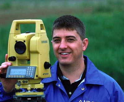
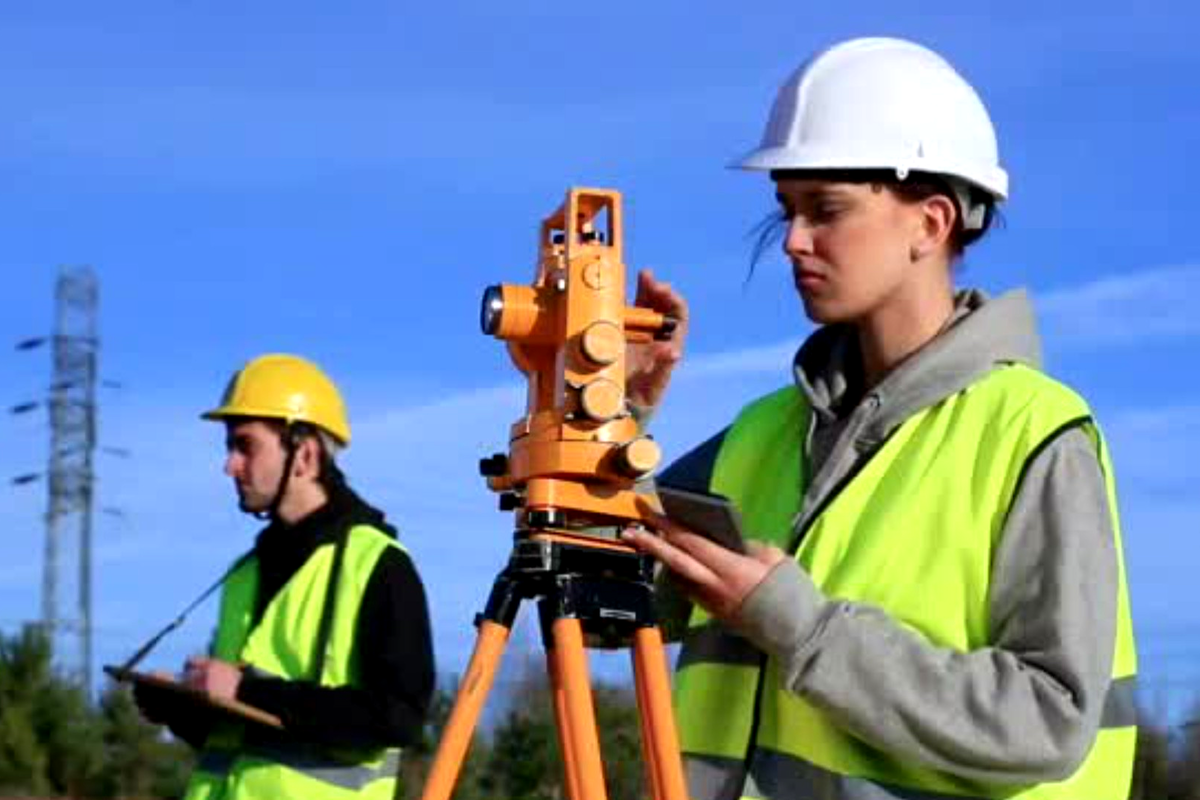
On ships, you often measure angles with a sextant. A theodolite is very similar but more suitable for making very precise measurements on the ground while a sextant measures the angle between two items, one of them usually the horizon. To the uninitiated, the device looks like a small telescope on a tripod. However, looking through the eyepiece will reveal a crosshair and some way to read the horizontal and vertical angles of the telescope. In the old days, this was probably just a pointer and scale but a modern device will have a digital readout.
Sometimes you hear these called transits. Actually, this is a special type of theodolite more properly known as a transit theodolite. The identifying feature is that the telescope is short enough to go full circle around the vertical axis. The idea is you could measure the angle one way, flip it around, and measure again. Averaging the results will reduce certain errors that have an opposite sign when you measure this way.
In addition to the telescope, there is a centering plate, levels, and a compass. (The centering plate is called a tribrach, which is an interesting instrument in its own right.) The idea is to be able to put the instrument in an exact place, level it, point it in a certain direction, sight and focus on a distant object, and then be able to read the azimuth and elevation to the target.
Grady at Practical Engineering will show you how surveyors use this instrument in the video below. He even gives you some homework to try if you want to get the topography of your backyard and don’t have a theodolite hanging around the garage.
History

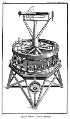
The theodolite seems like an obvious idea, but there were problems in calibrating the scales precisely. Jesse Ramsden solved this problem in 1787 and his instrument would go on to complete the first high-precision survey of all of Great Britain and Ireland.
Earlier instruments like the groma and dioptra only did part of what a theodolite can do. Early forerunners go back as far as the 1500s when several measuring devices that could go in both orientations appeared. However, incorporating everything — the telescope, the spirit levels, and a compass would wait until Jonathan Sisson’s 1725 instrument. But Ramsden made one with high precision due to his dividing engine to create precisely spaced markings. His dividing engine used a tangent screw mechanism that his improved screw-cutting lathe produced and could achieve one arcsecond (4.8 microradians) division. That is, a full circle would divide into almost 1.3 million parts.
For many years, the basic design didn’t change much. Sure, there were slight improvements and even adaptations for special purposes. For example, Edward Ritchie developed a theodolite for use on water that employed a pendulum to counteract wave movement. The U. S. Navy used these to survey harbors in the 1870s.
But it would be the 1920s when Heinrich Wild provided an optical path for the readings so that both angle measurements were visible through the instrument’s eyepiece. This was easier to use and less prone to dust and rain problems on external measuring scales.
In Use Today
Of course, surveyors use these instruments. But they also find use in tracking weather balloons and construction. These days a “total station” will measure everything electronically. They may also measure the distance to the target. Even in 1986, you could get a total station, and the video below shows a Wild Heerbrugg T2000 from the inside out.
Back in the day, theodolites were important for tracking rockets. Of course, these days, you can often use other means to find things like rocket altitude or exact locations.
Featured image from “Surveying & Mapping Technicians“, a video produced by the US Dept. of Labor.
